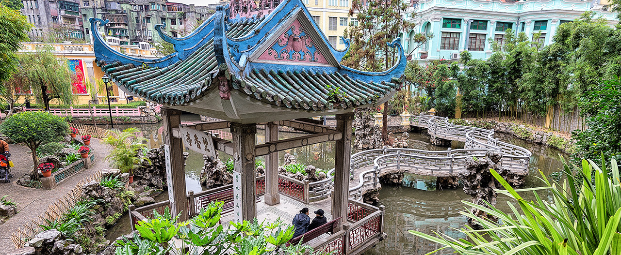
Hiking in Hong Kong is not part of the city’s image, but perhaps it should be. Most large cities let you get away from the crowds somehow, perhaps an hour’s drive away, but Hongkers is great for doing an urban hike. With an urban hike, you can use public transportation there and back, have dramatic scenery all the way, and still be close to services such as a good restaurant at the end. A hike wouldn’t be my first recommendation for Hong Kong, but after you’ve seen the sights and some great neighborhoods there, consider doing an urban hike to really enjoy the place. One such possibility is on Cheung Chau Island.
I first visited Hong Kong in 2001, spending a good amount of time there, and have been back five times. The city isn’t full of sights, no grand palace to visit or ancient ruin. It’s not an old city or a particularly beautiful one. Up close, it can be seriously ugly. Your friends raving about how beautiful the city is are talking about seeing the skyline across the water, with mountains in the background, because that’s the only thing making the place dramatic.
Water and mountains, plenty of them. Hong Kong is mountainous, not just hilly, and the civilization is all squeezed into the valleys and the few flat spaces. This makes neighborhoods awfully crowded and leaves plenty of green space, countryside, almost wilderness, about. These areas are often easy to reach, and make for a great urban hike.
On my last post, I detailed one urban hike in Hong Kong, on an outlaying island named Lamma, only about a half-hour ferry ride from the center of the city. One other island to visit is called Cheung Chau, where the hike is more challenging and interesting. It’s still an urban hike, but there are lots of ups and downs.
To get to Cheung Chau, take the subway to the central point on Hong Kong Island intelligently named Central. Come up, way up one level above street level, and take the outside pedestrian bridge towards the water. Look for signs saying “To all ferries” (or anything like that) and make your way to pier number 5. The ferry will leave once every half hour or so. You can use an Octopus Card (good for all public transport in HK) or there are machines inside that will make change for your ferry token. In just under an hour, you’re in Cheung Chau.

There are stairs involved
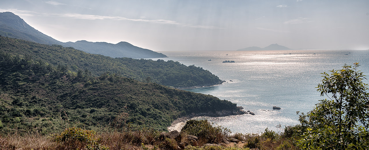
Cheung Chau has several hiking routes, but the most rewarding one goes around the southern half of the barbell-shaped island. It truly has something for everyone. This route will take you two to three hours, or of course more if you linger in spots. It could easily fill a long afternoon.
From the ferry, turn right, and then a quick left, to a pedestrian lane that has some shops where you can grab a snack or some beverages. Along here is a sacred banyan tree with a shrine, a small enclosure with charms hanging inside. I don’t know why it’s sacred.
Keep going straight, and you’ll come to the beach at Tung Wan. You’ve just crossed the island at its narrowest point. If you’re a beach freak, you may want to park it right here. For the others, or for some alternative and even less crowded beaches, turn right (south) and start your walk. The path runs by the Warwick Hotel and some windsurfing centers where probably you could rent some equipment. The beaches keep coming, though getting smaller and less crowded. At least one has a bar. At one spot, behind a glass case, is a 3,000 year-old rock carving.
The only Olympic athlete ever to win gold for Hong Kong did it in windsurfing, and he trained right here.
Keep turning left (towards the water) anytime a side path wants to head inland until you have no choice but to head inland and uphill a bit. Soon you’ll be in the woods, still on the path, and you’ll pass a group of flags that mark the small and cute Kwun Yam temple, set in a grove. It’s peaceful here, so work on your meditation for a bit. Or, take a break and drink one of the beer cans you intelligently stuffed into your backpack before setting out.
There’s a fork here, but keep going south and you’ll come to what someone named the “Mini Great Wall”. It is neither great nor a wall. Discuss. It’s really just a pathway made from marble-like blocks but its moniker has stuck and that’s what everyone uses, ah well. Little signs on the path point toward it, if you can’t recognize it. You’re up higher now, so you get some great views, over the hills of the island and of nearby islands.
Plaques along the way show you that the rocks above your head have names, mostly based on their shape, such as the “Human Head Rock”. In the direction you’re heading, they are right above you on a steep slope, so it’s hard to see them. Best strategy is to move past them and then turn around, looking backwards up the slope.
Eventually, the cute little mini Great & Mighty Wall runs out, to a square platform overlooking the sea. Dead end. But you’re no wimp, and so you’re not finished, not at all. After enjoying the views, turn around and walk back a bit, looking for the first side turn going inland and upward. It’s marked “Fa Peng”. You’ll find it. You already enduring some stair climbing to get here, but now it gets serious. Good thing you’re in shape.
After the climb, walk through the tree and bamboo forest. At some point near here, there’s a T-intersection unmarked in any way; turn right there. Keep looking to the left and you’ll see a small ruined house overgrown with jungle, just off the trail. The island has at least four (probably much more) well-known ruins like this, and it’s great fun to wander through this one.

Abandoned house. Could be yours
There are a few left turns ahead, the next after passing a housing complex, and then another where you’ll be closer to the coast. Here, you’ll come out above a small bay labeled Nam Tam Wan with a tiny and cute patch of sand. It’s probably a private beach for you, as there never seems to be anyone around. It’s probably time for the second beer at this point. Besides, it will lighten your load.
Head down, way down to the “beach”. You’re doing fantastic. Look inland and you may see some trees swept away from a typhoon only a few years ago. A small temple sits just beyond the beach, for all your spiritual needs.
From here, you will climb some stairs to one side of the temple, then make a left turn onto “Peak Road West”. It’s not really a road, just a footpath (there are no cars on the island anyway), but now you’re back in light civilization for a while. Don’t miss that left turn, as I did, or you’ll continue climbing a hell of a set of stairs that ends disappointingly in some school, and you’ll have to backtrack. Don’t be like me.
Now, directions are easy, just stay on the Peak Road, past some houses and then it becomes wooded again, right before the cemetery, a large one. Didn’t see that coming, but you’re walking right through it. It’s peaceful, as is right. Times like these, I like to pick out one grave and decide she’s my Cantonese grandmother. I bow to honor her and hope she’s at rest.

This cemetary is brought to you by “Blue Girl” beer
A turnoff here, I think just after the cemetery, leads to Pak Tso Wan, which is also known for some reason as Italian Beach. There are turnoffs all along the way, especially on this section, where you can do more exploring. Some involve a steep path down to the shoreline, and then a steep path back up.
We’re coming to the end now, but there are serious delights here. You’ll pass by a small village, coming to a flat beach part, and see a path to the left through a free-standing arch. Another left, look for signs to Cheung Po Tsi Cave.
Cheung Po Tsi is the name of a famous pirate who used to prowl these waters back in the late 18th century. He was kidnapped by pirates himself at age 15 and grew up to rule them all. At one point, he had 600 ships and 20,000 men, which sounds a bit grand for a pirate. This is all before Hong Kong as a city even existed. Later, in 1810, he surrendered to the local Chinese government and was given a high position in their navy.

Cheung Po Tsi stashed his pirate booty on various small islands around the area, one of the main caches here on Cheung Chau Island (the Cheungs are not related). A natural cave he used sits far down the rocks, close to the water. Follow the signs and you’ll descend a long set of stairs cut into the rock to see the cave, which is of course totally empty today. There’s really nothing to see. To totally get into the cave, you’ll need a light source. The flashlight app on your phone should work, but a torch would be better.
In the movie version of this hike, of course, you’d have clues to where he stashed his treasure, and some decedents of Pirate Cheung would show up, most of them rather good-looking.
One more delight awaits, and oh this is good. Near the highest point on this little see-the-cave trail is a turnoff labeled “Reclining Rock”. Take this. The going gets tougher here, steep descents through holes in the massive rocks down to the beach, where you’re left among more rocks. I first discovered this route back in 2001 and it was a delightful surprise. The best way to discover it would be by chance, as I did, but I can’t leave that to fate—I must tell you why this is fun.

Some of the routes in Reclining Rock
This is why the movie version will work: To keep going, are you willing to figure out the route yourself, to solve the puzzles? You quickly come to water, but then you realize that strategically-placed stones will carry you across it, and realize the stones are no accident. You’re being led. There’s a giant rock in your way now, but you find to the side are steps cut in its surface, along with a rope hanging down to help pull you up. There’s a pool you must cross, but hey, here’s a short ladder to the side seemingly going to nowhere, except, wait, you could use the ladder to get to this ledge that will take you across.
These obstacles, and their solutions, go on. Few people do this part of the route, and you’ll possibly have it to yourself. You’re like some jumping and climbing Mario in a video game figuring out how to get through. At one point you’re threading narrow passages through giant square blocks, some which connect, some which are dead ends. We’ll see where you end up. It’s all grand, and further grand for being a public place.

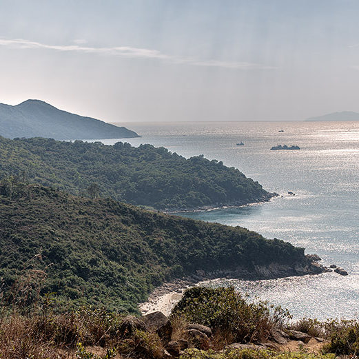
The harbor
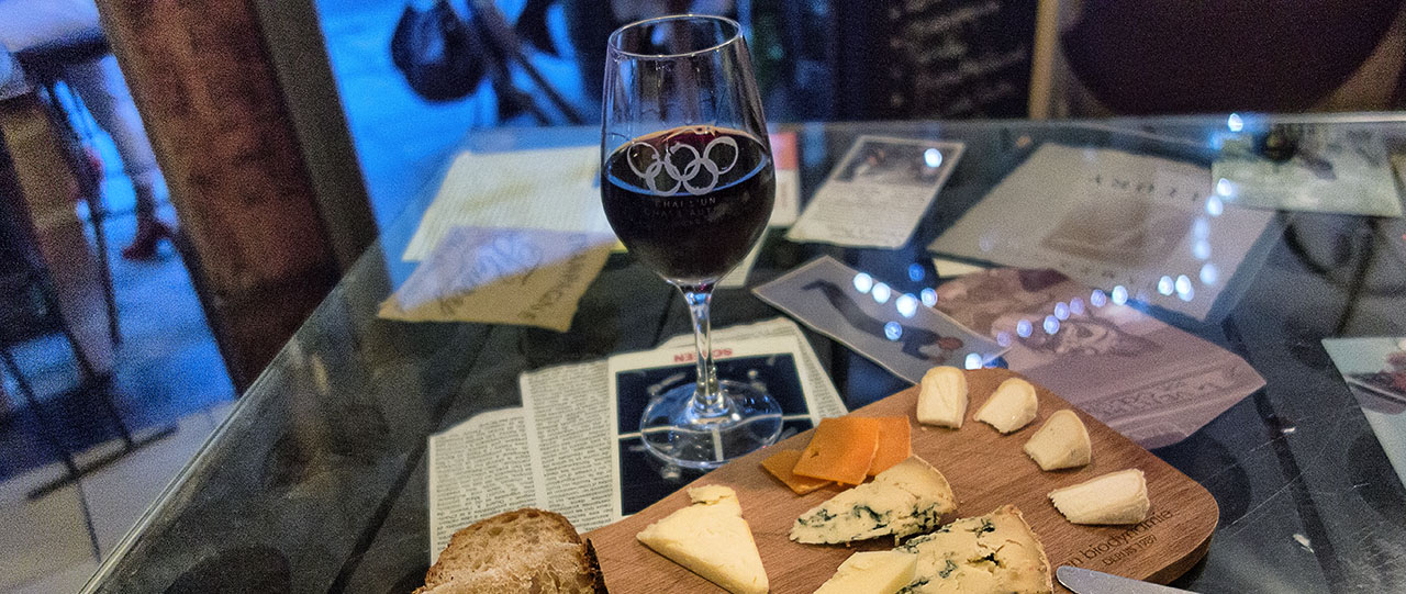
However you go, come back by the cave side trail again, and you’ll be a bit south of the ferry terminal and the village around it, an easy walk up. I was there in the village sitting at the Pink Pig, an open-sided bar perfectly placed to catch people like you and me coming back from our urban hike. I’m drinking a Hong Kong Pale Ale [www.hkbeerco.com], since Hongkers has finally caught up to the craft beer trend. The young couple running the place is grand. There’s food here too, but Western food, and that’s not what we want.
What we want is to keep walking north, past the ferry terminal where a dozen or more seafood places line the waterfront. They are all similar, in food and prices, and I’ll just let you pick your fancy. My dinners here have been wonderful, and I must recommend the seafood-with-garlic formula. I’ve had shrimp with garlic every meal here, along with scallops with garlic once, and they’re both beyond brilliant. Although—at one place I had some fried seafood fritters and a large Tsingtao beer that didn’t sit well. An hour later, back up they came.

One of my more successful meals — scallop with garlic
The ferry times are posted outside the terminal, so check them before you settle in anyplace. If you’re there late, the sunset over the harbor is grand. A 55-minute ferry ride later, you’re back in the crowded megacity, ready for an urban evening after your island hike.


I really appreciate your writings. You have perfectly explained all the details of the topic.